to home page«Home
WINTERBOURNE
South Gloucestershire
HTML coding on this page meets W3C standardsCSS coding on this page meets W3C standardsThis page has been labelled to ICRA standards

Memories of Winterbourne

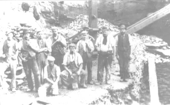
In 1996, children at a local primary School interviewed friends and neighbours about their early life in Winterbourne as part of a class history project. Some documents from this project have recently been discovered in the school archives and a compilation of some of these memories is presented here. Most of the photographs used by the children were taken from the excellent "A Photographic Record of Winterbourne" by Arthur Townley-Parker, now out of print.

IF YOU WERE PART OF THIS PROJECT IN 1996 » I'D LOVE TO HEAR FROM YOU!
There was a grocery shop in Salem Road. Opposite the chapel there was a sweet shop. 
The Co-op used to deliver things to the house and come round with orders.
Beaver Close used to be a scrap yard. The Fromeside Club used to be Hoppers Farm
Where the bank was was a grocers and clothes shop. There used to be an old barn where 
the Co-op is now, where all the vegetables were washed and sorted and we 
would sell them from the house next door and send them to market.
The old Co-op is where Jack and Jill hairdresser and Break charity shop are now.
Donkey terrace used to be the main street. 
Harris's used to be Draisey's and there was a petrol and paraffin pump outside. 
There used to be a cycle shop with a petrol pump where the BP garage is. There 
was a shop owned by Mrs Bignall where Abbott Mansons is now. 
MacKendrick Norcott's was Hollister's paper Shop. There was a cobblers shop next
 to the Mason's pub. There was a trouser shop and hat shop in Watleys end. 
There were no shops in Flaxpits Lane. Milk was sold door-to-door from the churn 
from a horse and cart (later, a van).
The old police house used to be by the Royal Oak. There were two farms down by 
the church which are no longer farms.
Sullivans used to have a market garden at the top of Cloisters by Hicks Common Road. 
There was a mill at Harcombe farm where a blind donkey used to turn it. 
The field in the church lane that still has the waterpump in it used to be an orchard.
There used to be a school in Dragon Road at Bourne House. The Headmaster's house
joined on to it. It was closed when St Michael's Primary School opened in the
 High Street.
There was a pub called "The Prince of Wales" in the house next to the Co-op and 
another pub down Beacon Lane called "The Lion". 
Children made up their own games like a hoop and stick.
Beacon Lane was narrow with not much traffic. Boys used to ride a land yacht or trolley 
down the lane. There used to be a hump-back bridge over the river.
There was a fish and chip shop at Winterbourne Hill.
On Dragon Road there was a row of council houses with long front gardens. They 
were replaced with rows of houses and a cul-de-sac and a block of flats. 
More houses were built in what were large gardens.
St.Michael's School moved from the High Street to Linden Close.
Shops in Bradley Avenue: Chemist, Grocery Store.
Salem: Wool Shop, Barber Shop, Grocery Shop.
Watley's End: Hairdresser's.
McKendrick Norcott used to be a newsagent. The bank used to be a grocery shop. 
Christine Peters used to be an electrical shop.
The garden of "The Mount" was sold off and houses built in the garden.
New telephone exchange built next to Elm Park School. The Old Exchange on Bristol 
Road was converted into a Postal Sorting Office.
Fields in Cloisters Road and Hicks Common Road now used for grazing used to be
 planted with vegetables.
Many trees were lost to Dutch Elm disease.
"Break" charity shop used to be a wallpaper shop with a cafe at the rear.
The area of Watleys End was principally allotments with a few cottages here and 
there. The High Street had a ditch down one side, opposite the Wheatsheaf - no 
pavement. Tarmac was not around and so the roads were in poor condition.
Friary Grange Park, Parkside Avenue and the area north of the library were
allotments and fields, therefore no roads. Watleys End Road was prefabs, a 
football field and fields.
Winterbourne Station used to have two platforms with a connecting bridge. There 
was a woman porter - Gladys Maggs. 

hand-drawn map of the old High Street (artist unknown).
The only pub to close was "The Brewery" in Salem Road. Mrs Maggs had a grocery 
shop on the corner of Common and Salem Road. There was a hairdressers' at 142 
Watleys End Road, later a pet shop, now a house. Forty years ago only a quarter
of houses had cars.
Winterbourne Station was on the line from Swindon to Bristol and had three 
trains in each direction at about 8am, 1pm and 6pm. In the summer there were 
excursions to Weston-Super-Mare, and the cricket match at Badminton.
hand-drawn map of the area around Elm Park School (artist unknown). 1960 aerial photograph of the Crossman Avenue area under construction (source unknown). faded photograph of seven ladies in aprons outside a house (source unknown). faded photograph of nine workmen (in a quarry?)(source unknown).